
Emma Paz
{GIS Professional • Developer • Enthusiast}
B I E N V E N I D O S
Thanks for visiting my online portfolio.
Please, have a look around...
Check out how I've developed into yours truly.
This portfolio of GIS applications showcases some of my work—projects in which I've taken the Lead Developer role.
While each project showcases a variety of different layouts and features, all applications are mobile-ready and accessible from any device—they are built using Esri's REST and JavaScript APIs as well as responsive-design frameworks like Materialize, Bootstrap & Calcite.
Of course, good looks aren't everything. My UIs are complemented by efficient server-side and client-side code (I use a variety of tools like ColdFusion, PHP, Python and Node.js), in order to handle the complex GIS data that is backed by ArcGIS Enterprise and Microsoft SQL resources.

City of Charleston, SC | Mapping application to identify property-based information throughout the City area.
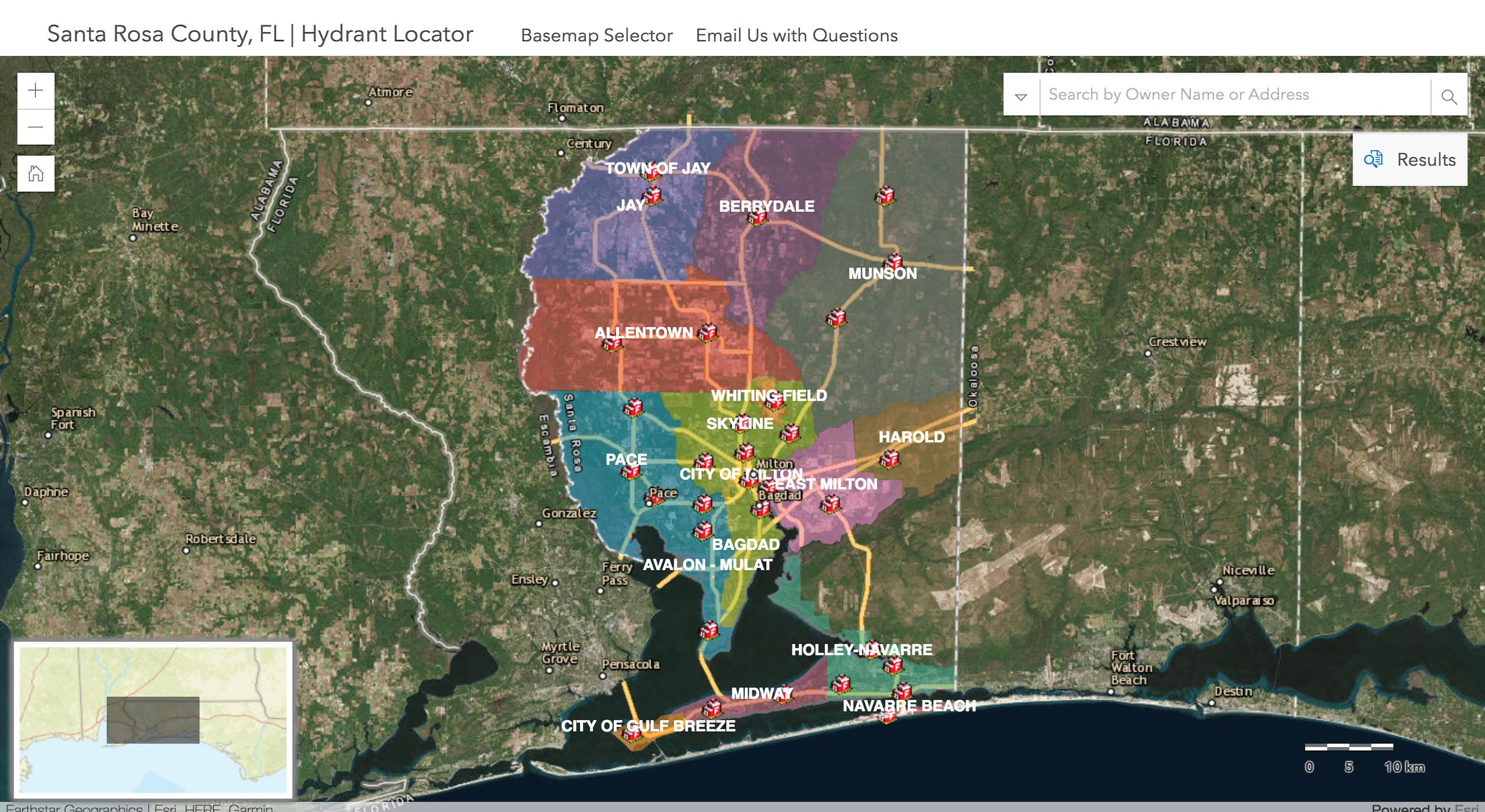
Santa Rosa County, FL | Mapping tool to search for hydrants near parcel properties.
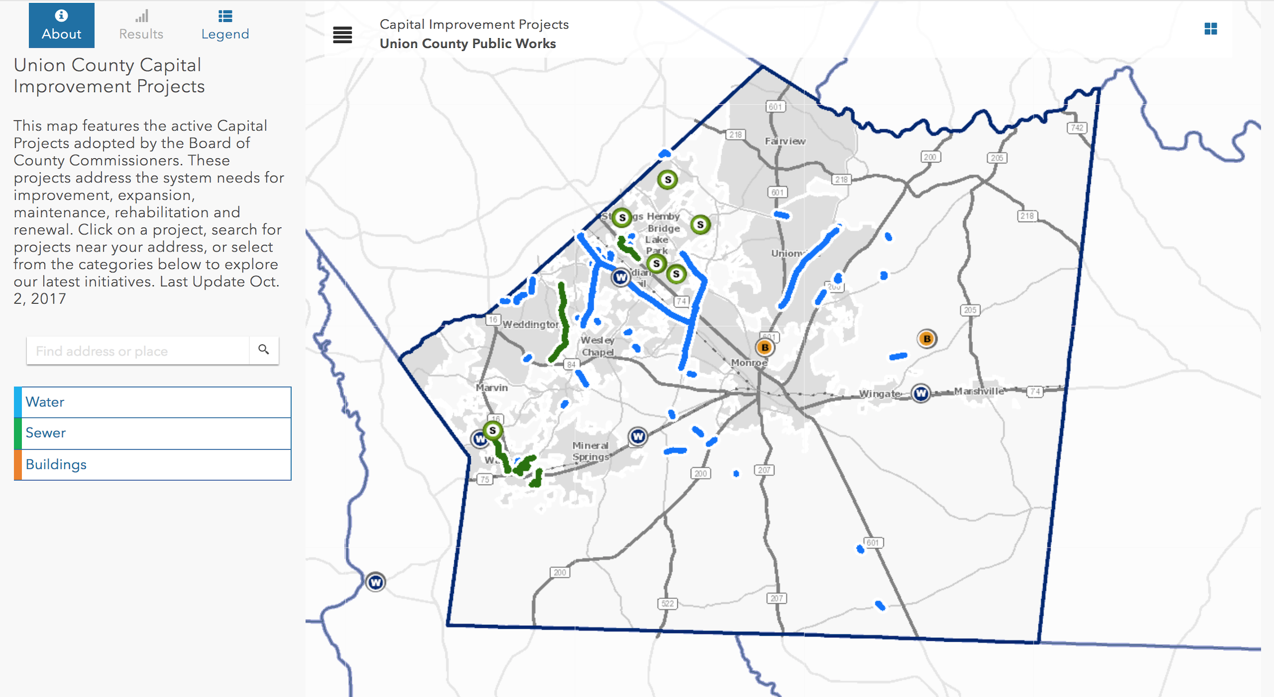
Union County, NC | Application to view Capital Improvement Projects throughout the county.
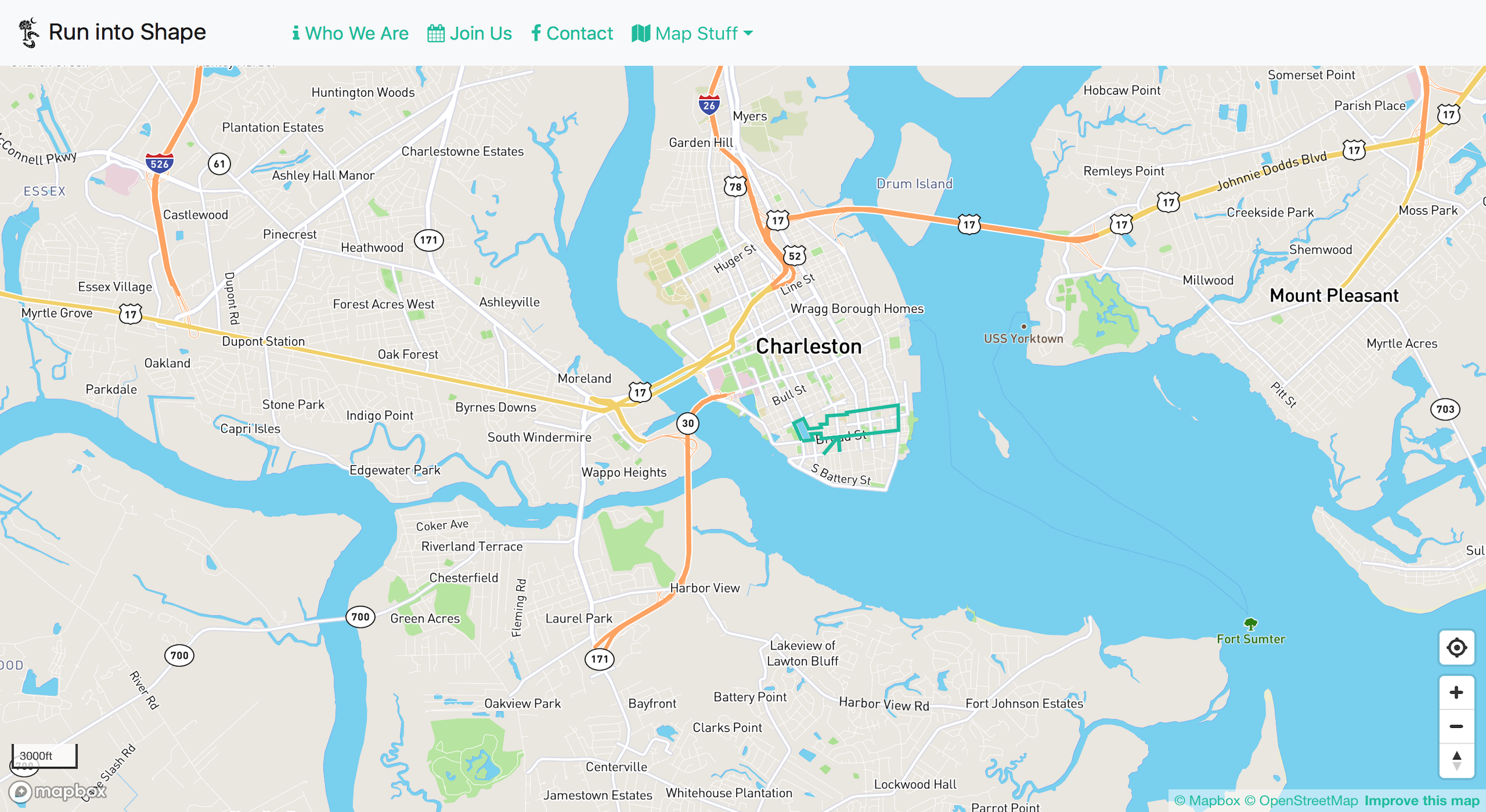
Run into Shape CHS | Map displaying routes for my Charleston Running Group.
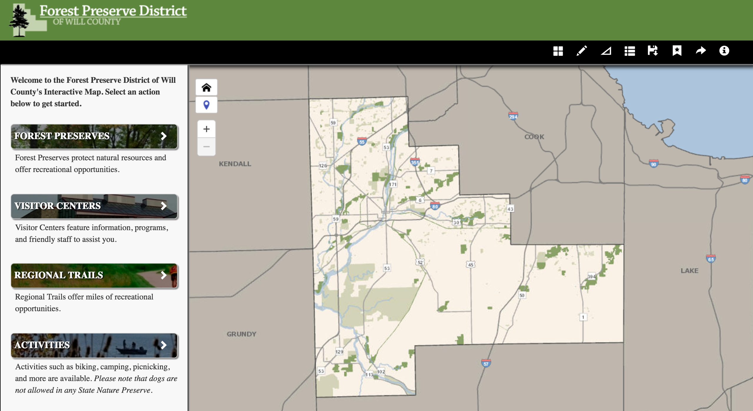
Forest Preserve District of Will County, IL | Application to explore Forest Preserves, including activities and amenities.

SC Aquarium | Mobile-friendly Sea Level Rise Viewer with local statistics.
-
assignmentGIS Developer @ the City of Charleston since Jun 2018
- chevron_right Collaborate with City Departments to design custom GIS solutions that serve both internal and public needs & goals.
- chevron_right Write server-side (Python, PHP) and client-side (JS/HTML) code to maintain existing sites and build custom GIS web applications/functionality.
- chevron_right Automate workflows to keep data and map services updated across applications, consolidating resoures and maximizing query/drawing speeds when possible.
- chevron_right Fulfill GIS duties on the Emergency Management Team during times of need.
- chevron_right Attend and represent the City at conferences and workshops, presenting about our GIS projects when possible.
- chevron_right City of Charleston GIS Site
-
assignmentGIS Instructor @ the College of Charleston since Aug 2016
- chevron_right Teach ArcGIS-based curriculum to undergraduate and graduate-level students in Introduction to Geographic Information Systems course.
- chevron_right Serve as advisor for student thesis research committees.
- chevron_right Santee Cooper GIS Lab Online
-
assignment_turned_inGIS Developer @ ROK Technologies Jan 2014 - Jun 2018
- chevron_right Managed and configured client data in ArcGIS and SQL Server SDE environments.
- chevron_right Worked to design, write, debug, deploy, and maintain GIS and database-driven, responsive-design web applications and websites.
- chevron_right Contributed written and media content for website and newsletter communications; led software training as needed.
- chevron_right Represented ROK at various conferences throughout the year.
-
assignment_turned_inGIS Manager (Independent Contract) Jan 2017 - Nov 2017
- chevron_right Managed data and map production for a National Park Service research project with Social Science Professor Dr. Annette Watson at the College of Charleston.
-
flareTechnical Proficiencies, Certifications & Awards
- chevron_right ArcGIS Platform components including ArcGIS Server v. 10.X, ArcGIS GeoEvent, ArcGIS Portal, ArcGIS Desktop v. 10.X, ArcGIS Online, ArcGIS Pro, ArcGIS Server REST API, and ArcGIS JavaScript API.
- chevron_right 3rd-Party/Open Source APIs: amCharts, Commerce.js, DarkSky, Google Maps, Mapbox-gl.js, NWS & NOAA COOPS.
- chevron_right Programming languages & libraries: ASP.NET, Bootstrap, Calcite, ColdFusion, CSS3, Git/GitHub, HTML, JavaScript, jQuery, JSON, Materialize, Node.js, PHP, Python, REST, RDBMS, SOAP, SQL, XML.
- chevron_right Graphics Software Tools: iMovie, Adobe Illustrator & Photoshop, Corel Paintshop
- chevron_right Amazon Web Services: Certified as Associate Developer (2016 through 2018)

Thesis: The importance of vegetation in a statewide carbon budget...
Advisor: Dr. Norm Levine
Research Project: emporal and spatial study of phytoplankton communities...
Advisor: Dr. Joseph Dirnberger
This map highlights my journey through space. These marked locations are special places—important in the making of... me.